
Planning trips on public transit
Planning trips on public transit
Guía rápida
There are several apps for planning trips on New York's public transit (the subway, buses and taxis). For my money, the best one is Google Maps.
Since not everyone has an international data plan, the good news is that you can check your routes from plenty of spots around the city, because there are more and more free wifi zones in New York.
How to plan trips with Google Maps

Planning trips on New York's public transit with Google Maps is really easy. Here's how to do it step by step:
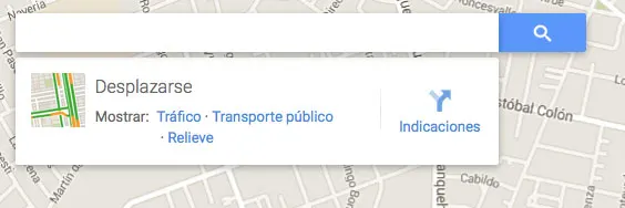
1) Open the app and type in your starting address in the search bar:
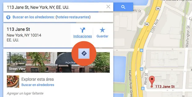
2) In this example I'll use the address of The Jane hotel (highly recommended, by the way!) as the starting point, then hit the directions link (that's how it looks on desktop) or the arrow icon, «get directions«, that shows up in the mobile apps, circled in orange here so you can spot it.
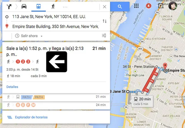
3) Next, type in your destination address, in this example the Empire State, then tap the public transit icon (the little subway symbol, in blue here), the car icon if you're driving, or the pedestrian one if you plan to walk there.
You'll then see different connections to get to your destination. Click the one that works best for you. In this case we chose to ride subway lines 1, 2 or 3:
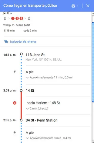
4) Besides showing your route clearly marked on the map, clicking «details» gives you the step-by-step connection details, like in the image below.
Notice that it also shows the distance and estimated time for each leg, so you really can't get lost!
5) If you found this useful, give us a like on Instagram so we can keep helping more travelers get to know and explore New York easily 🙂
Guide to New York public transit
If you need more detailed info on the different modes of public transit in New York, check out this complete Guide to NYC Public Transit. In it I explain how to use the subway, the buses, the taxis, the public bikes, how to get to and from the airports, and even how to walk in NYC, because there's a science to that too 😉